Verfeinern Sie Ihre Suche
Auktionshaus-Kategorie
Kategorie
Sortieren nach:
- Kategorie
- Liste
- Galerie
-
45 Los(e)/Seite
Ein Abonnement der Preisliste ist notwendig um Ergebnisse, von Auktionen die vor einem längeren Zeitraum als 10 Tagen stattgefunden haben, ansehen zu können. Klicken Sie hier für mehr Informationen

Africa.- Alexander (Capt. J. E.) An Expedition of Discovery into the Interior of Africa, 2 vol. …
Africa.- Alexander (Capt. J. E.) An Expedition of Discovery into the Interior of Africa, 2 vol. bound as 1, first edition, 7 plates, illustrations...
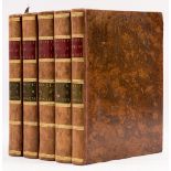
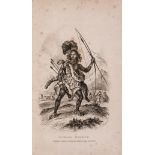
Africa.- Bruce (James) Travels to Discover the Source of the Nile ..., 5 vol., first edition, 1790.
Africa.- Bruce (James) Travels to Discover the Source of the Nile ..., 5 vol., first edition, all but vol. 5 with half-titles, engraved vignette t...
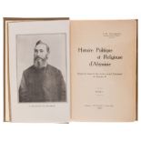
Africa.- Coulbeaux (J.-B.) Histoire Politique et Religieuse d'Abyssinie, 3 vol., first edition, …
Africa.- Coulbeaux (J.-B.) Histoire Politique et Religieuse d'Abyssinie, 3 vol., first edition, portrait frontispiece, plates and illustrations, 6...

Africa.- Ethiopia.- Dimothéos (R. P.) Deux ans de Séjour en Abyssinie ou vie Morale, Politique et …
Africa.- Ethiopia.- Dimothéos (R. P.) Deux ans de Séjour en Abyssinie ou vie Morale, Politique et Religieuse des Abyssiniens, 2 vol. bound as 1, h...
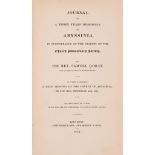
Africa.- Ethiopia.- Gobat (Rev. Samuel) Journal of a Three Years' Residence in Abyssinia, in …
Africa.- Ethiopia.- Gobat (Rev. Samuel) Journal of a Three Years' Residence in Abyssinia ..., first edition, half-title, double-page engraved map,...
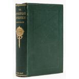
Africa.- Ethiopia.- Markham (Clements R.) A History of the Abyssinian Expedition, first edition, …
Africa.- Ethiopia.- Markham (Clements R.) A History of the Abyssinian Expedition, first edition, half-title, 5 lithographed maps, 4 folding, publi...

Africa.- Fitzgerald (William Walter Augustine) Travels in the Coastlands of British East Africa …
Africa.- Fitzgerald (William Walter Augustine) Travels in the Coastlands of British East Africa and the Islands of Zanzibar and Pemba, first editi...

Africa.- Lepsius (Dr. Richard) Letters from Egypt, Ethiopia, and the Peninsula of Sinai, first …
Africa.- Lepsius (Dr. Richard) Letters from Egypt, Ethiopia, and the Peninsula of Sinai, first edition, colour frontispiece, vignette title, 2 fol...

India.- Robertson (William) An Historical Disquisition concerning the Knowledge which the Ancients …
India.- Robertson (William) An Historical Disquisition concerning the Knowledge which the Ancients had of India, first edition, half-title, 2 fold...

India.- Stein (Sir Marc Aurel) On Alexander's Track to the Indus, first edition, 1929; and another …
India.- Stein (Sir Marc Aurel) On Alexander's Track to the Indus, first edition, half-title, frontispiece, plates, 2 folding, 2 folding maps at en...

Middle East.- Philby (Harry St. John Bridger) The Empty Quarter, first edition, 1933; and others …
Middle East.- Philby (Harry St. John Bridger) The Empty Quarter, first edition, frontispiece, plates, 3 folding maps, 2 at end, scattered faint sp...

World.- Diodorus (Siculus) The Historical Library of Diodorus the Sicilian ... contain the …
World.- Diodorus (Siculus) The Historical Library of Diodorus the Sicilian ... contain the Antiquities of Egypt, Asia, Africa, Greece, the Islands...

World.- Arrowsmith (Aaron) A New General Atlas... of all the Known Countries in the World, 1817
World.- Arrowsmith (Aaron) A New General Atlas... of all the Known Countries in the World, engraved title, index and 53 maps, a few with hand-colo...

World.- Blackie (W.G.) The Imperial Atlas of Modern Geography, 100 maps over 75 double-pages, mounted on stubs, including the Arabian Peninsula, I...

World.- Doppelmayr (Johann Gabriel) Basis Geographiae Recentioris Astronomica in qua Situs Locorum …
World.- Doppelmayr (Johann Gabriel) Basis Geographiae Recentioris Astronomica in qua Situs Locorum Insigniorum Geographici ea Exactitudine, qua Ce...

World.- Laurie & Whittle (publishers) A New Chart of the World on Wright's or Mercator's Projection in which are Exhibited all the Parts Hitherto ...

World.- Meyer (Joseph) Neuester Universal-Atlas fur Alte & Neue Erdkunde, 89 engraved maps, …
World.- Meyer (Joseph) Neuester Universal-Atlas fur Alte & Neue Erdkunde, title, index, and 89 engraved maps with outline hand-colouring, the cele...

World.- Northern hemisphere.- Van der Aa (Pieter) Planisphere Terrestre, Suivant les nouvelles …
World.- Northern hemisphere.- Van der Aa (Pieter) Planisphere Terrestre, Suivant les nouvelles Observations des Astronomes, map of the World based...

World.- Plancius (Petrus) Orbis Terrarum Typus de Integro Multis in Locis Emendatus auctore Petro …
World.- Plancius (Petrus) Orbis Terrarum Typus de Integro Multis in Locis Emendatus auctore Petro Plancio, double-hemisphere world map, after Merc...

World.- Santini (Francois) and G.A. Raimondi. Nouvelle Mappe Monde dediee au progres de nos …
World.- Santini (Francois) and G.A. Raimondi. Nouvelle Mappe Monde dediee au progres de nos connoissances, double-hemisphere world map, decorative...

World in miniature.- Mercator (Rumold) Orbis Terrae Compendiosa Descriptio ex ea, quam ex Magna …
World in miniature.- Mercator (Rumold) and Giovanni Magini. Orbis Terrae Compendiosa Descriptio ex ea, quam ex Magna Universali Mercator Rumoldus ...

Atlases.- Blaeu (Joan) Atlas Maior of 1665, facsimile edition, Taschen, 2005; and 15 others (16)
Atlases.- Blaeu (Joan) Atlas Maior of 1665, facsimile edition, colour illustrations throughout, original boards, dust-jacket a fine copy, preserve...

Atlases.- Johnston (Alexander Keith) & G. H. Johnston. The Handy Royal Atlas of Modern Geography, …
NO RESERVE Atlases.- Johnston (Alexander Keith) & G. H. Johnston. The Handy Royal Atlas of Modern Geography, 2 folding map frontispieces, 59 doubl...

Atlases.- Kitchin (Thomas) Kitchin's General Atlas, Describing the Whole Universe, 18 maps only, …
Atlases.- Kitchin (Thomas) Kitchin's General Atlas, Describing the Whole Universe, title, with 18 maps only (of 40), lacking the maps of America a...

Africa.- De L'Isle (Guillaume) Carte d'Afrique Dressee pour l'Instruction par Guillaume Delisle, …
NO RESERVE Africa.- De L'Isle (Guillaume) Carte d'Afrique Dressee pour l'Instruction par Guillaume Delisle, double-page map of Africa, engraving w...
![Africa.- Ortelius (Abraham) Africae Tabula Nova, engraved map, [c.1570-1612].](https://portal-images.azureedge.net/auctions-2022/forum-10345/images/3b0b6217-bbb4-484b-8166-af5700fcb06b.jpg?w=155&h=155)
Africa.- Ortelius (Abraham) Africae Tabula Nova, detailed map of Africa based upon Gastaldi's 8 sheet wall map and Mercator's world map of 1569, d...
![Africa.- Waldseemüller (Martin) Tabula Quarta Africae, woodcut map, [c. 1513].](https://portal-images.azureedge.net/auctions-2022/forum-10345/images/5eb8729f-fc1b-49e6-87e5-af5700fcb370.jpg?w=155&h=155)
Africa.- Waldseemüller (Martin) Tabula Quarta Africae, Ptolemaic Map of Northern Africa, woodcut, on laid paper with small watermark of a crown, s...

Balkans.- De Bosset (Lieut.-Colonel C. P.) Proceedings in Parga and the Ionian Islands, first …
Balkans.- De Bosset (Lieut.-Colonel C. P.) Proceedings in Parga and the Ionian Islands, first edition, folding engraved map, B1 with small hole af...

Canada.- Davis Strait.- Keulen (Gerard van) Nieuwe Platte Paskaart van de Straat Davids, engraved …
Canada.- Davis Strait.- Keulen (Gerard van) Nieuwe Platte Paskaart van de Straat Davids, large chart with inset of the South Bay of Greenland, eng...
![China.- Blaeu (Willem Jansz. and Johannes) China Veteribus Sinarum Regio, engraved map, [c. 1640]](https://portal-images.azureedge.net/auctions-2022/forum-10345/images/498396cd-4969-466a-9db1-af5700fcc50a.jpg?w=155&h=155)
China.- Blaeu (Willem Jansz. and Johannes) China Veteribus Sinarum Regio, engraved map, [c. 1640]
China.- Blaeu (Willem Jansz. and Johannes) China Veteribus Sinarum Regio, map of China, Korea and Japan, with decorative cartouche in the upper ri...
![China.- Blaeu (Johannes) Imperii Sinarum Nova Descriptio, engraved map, [1655].](https://portal-images.azureedge.net/auctions-2022/forum-10345/images/3ad96e03-b0f7-4074-9310-af5700fcc7dc.jpg?w=155&h=155)
China.- Blaeu (Johannes) Imperii Sinarum Nova Descriptio, map of China, Korea and Japan, published in the Jesuit Martino Martini's 'Atlas Sinensis...

China.- d'Anville (Jean Baptiste Bourguignon) Carte Generale de la Chine Dressée sur les Cartes …
China.- d'Anville (Jean Baptiste Bourguignon) Carte Generale de la Chine Dressée sur les Cartes Particulieres Que l' Empereur Chang-Hi a fait leve...

China.- d'Anville (Jean Baptiste Bourguignon) and Jean Baptiste Du Halde. Carte la plus generale …
China.- d'Anville (Jean Baptiste Bourguignon) and Jean Baptiste Du Halde. Carte la plus generale et qui comprend la Chine, la Tartarie chinoise et...

Europe.- Jaillot (Alexis-Hubert) Collection of 13 maps of Europe, mainly late 17th century; with …
Europe.- Jaillot (Alexis-Hubert) Collection of 13 maps of Europe, including double-page maps of the British Isles, France, Spain, Germany, Russia ...
![Greece.- Speed (John) Greece, engraved map, [1676]](https://portal-images.azureedge.net/auctions-2022/forum-10345/images/cadee030-2794-4935-9b83-af5700fcec63.jpg?w=155&h=155)
Greece.- Speed (John) Greece, engraved map with hand-colouring, on laid paper, platemark sheet 395 x 510 mm (15 1/2 x 20 1/8 in), under glass, cen...
![Holy Land.- Anonymous (active 1950s) Hasahar Hapore [The Fertile Crescent], map, [1958]; and 27 …](https://portal-images.azureedge.net/auctions-2022/forum-10345/images/dc3061da-96ce-4fcb-b293-af5d00c73709.jpg?w=155&h=155)
Holy Land.- Anonymous (active 1950s) Hasahar Hapore [The Fertile Crescent], map, [1958]; and 27 …
Holy Land.- Anonymous (active 1950s) Hasahar Hapore [The Fertile Crescent], Hebrew map showing Israel, Cyprus, Lebanon, The Kingdom of Jordan, Syr...

India.- Dury (Andrew) A Map of the Provinces of Delhi, Agrah, Oude, and Ellahabad..., engraved …
India.- Dury (Andrew) A Map of the Provinces of Delhi, Agrah, Oude, and Ellahabad, comprehending the Countries lying between Delhi, and the Bengal...

India.- East Indies.- Laurie (Richard Holmes) A New General Map of the East Indies... and the …
India.- East Indies.- Laurie (Richard Holmes, publisher) A New General Map of the East Indies... and the Dominions of the English East India Compa...

India.- Laurie & Whittle (publishers) A New Map of the Jaghir Lands, engraved map, 1794; and …
India.- Laurie & Whittle (publishers) A New Map of the Jaghir Lands, on the Coast of Coromandel, The Territory Belonging To The East India Company...

India.- Laurie & Whittle (publishers) A New Map of Hindoostan from the latest authorites made by …
India.- Laurie & Whittle (publishers) A New Map of Hindoostan from the latest authorites made by Major James Rennell, Surveyor General to the Hble...

Middle East.- U.S. Geological Survey (Saudi Arabian Project) Topographic Map of the Arabian …
Middle East.- U.S. Geological Survey (Saudi Arabian Project) Topographic Map of the Arabian Peninsula, double-sided information booklet, with 2 ma...

South America.- Argentina & Uruguay.- Arrowsmith (Aaron) A map of part of the Viceroyalty of …
NO RESERVE South America.- Argentina & Uruguay.- Arrowsmith (Aaron) A map of part of the Viceroyalty of Buenos Ayres, engraved map with hand-colou...

South America.- Blaeu (Willem Jansz.) and Jodocus Hondius. Venezuela, cum Parte Australi Novae …
NO RESERVE South America.- Blaeu (Willem Jansz.) and Jodocus Hondius. Venezuela, cum Parte Australi Novae Andalusiae, showing the northern coast o...

South America.- Sayer (Robert) A Map of South America Containing Tierra-Firma, Guayana, New …
South America.- Sayer (Robert) A Map of South America Containing Tierra-Firma, Guayana, New Granada Amazonia, Brasil, Peru, Paraguay, Chaco, Tucum...

Turkey.- Constantinople.- von Moltke (Helmuth) Karte von Constantinopel den Vorstaedten, der Um …
Turkey.- Constantinople.- von Moltke (Helmuth) Karte von Constantinopel den Vorstaedten, der Um Gegend und dem Bosphorus, map centered on plan of ...
-
45 Los(e)/Seite