57
Frankreich/Bretagne. - Carte Nouvelle des Costes De Bretagne depuis St. Malo jusques à l'emboucheure
1/2


Auctioneer has chosen not to publish the price of this lot
Köln
Description
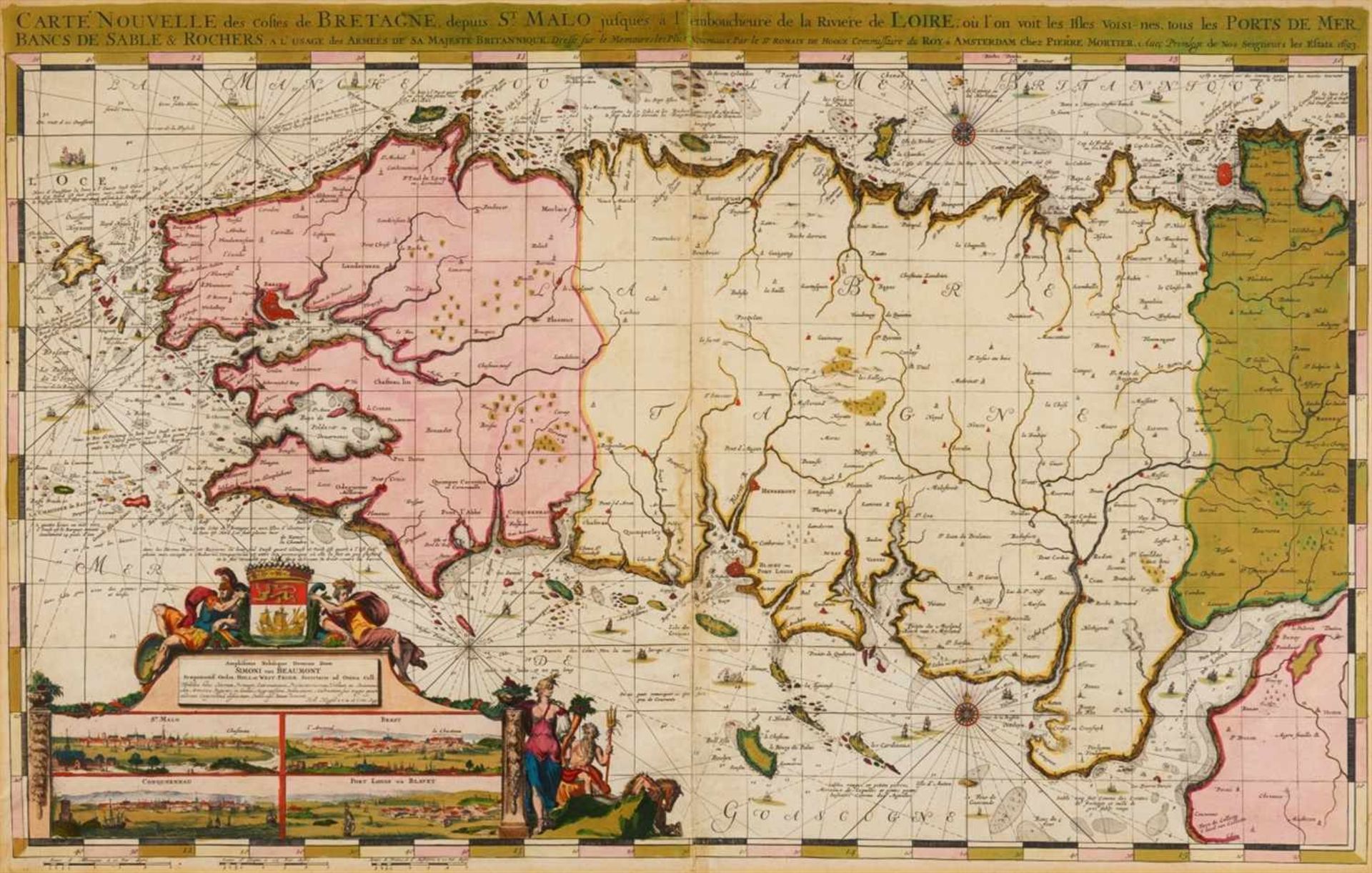
Frankreich/Bretagne. - Carte Nouvelle des Costes De Bretagne depuis St. Malo jusques à l'emboucheure de la Riviere de Loire ... Seekarte mit den vorgelagerten Inseln, figürlicher Kartusche und Inset-Ansichten von Saint-Malo, Brest, Conquerneau und Port-Louis.
Kolorierte Kupferstichkarte, bei Pierre Mortier, von Romeyn de Hooghe, 1693. Plattengröße 59,5 x 96 cm, Blattgröße 64 x 98,5 cm.
Verso umlaufend Montageband, Mittelfalz sowie einige weitere, kleinere Risse und Papierdefekte hinterlegt. In den Rändern und im Bereich um den Mittelfalz etwas gebräunt bzw. lichtrandig.
Auction Details
Shipping
T&Cs & Important Info
Ask seller a question
Frankreich/Bretagne. - Carte Nouvelle des Costes De Bretagne depuis St. Malo jusques à l'emboucheure de la Riviere de Loire ... Seekarte mit den vorgelagerten Inseln, figürlicher Kartusche und Inset-Ansichten von Saint-Malo, Brest, Conquerneau und Port-Louis.
Kolorierte Kupferstichkarte, bei Pierre Mortier, von Romeyn de Hooghe, 1693. Plattengröße 59,5 x 96 cm, Blattgröße 64 x 98,5 cm.
Verso umlaufend Montageband, Mittelfalz sowie einige weitere, kleinere Risse und Papierdefekte hinterlegt. In den Rändern und im Bereich um den Mittelfalz etwas gebräunt bzw. lichtrandig.
Kolorierte Kupferstichkarte, bei Pierre Mortier, von Romeyn de Hooghe, 1693. Plattengröße 59,5 x 96 cm, Blattgröße 64 x 98,5 cm.
Verso umlaufend Montageband, Mittelfalz sowie einige weitere, kleinere Risse und Papierdefekte hinterlegt. In den Rändern und im Bereich um den Mittelfalz etwas gebräunt bzw. lichtrandig.
Spring Sales 2019
Sale Date(s)
Venue Address
Cäcilienstrasse 48
Köln
50667
Germany
For Venator & Hanstein delivery information please telephone +49 (0)221 2575419.